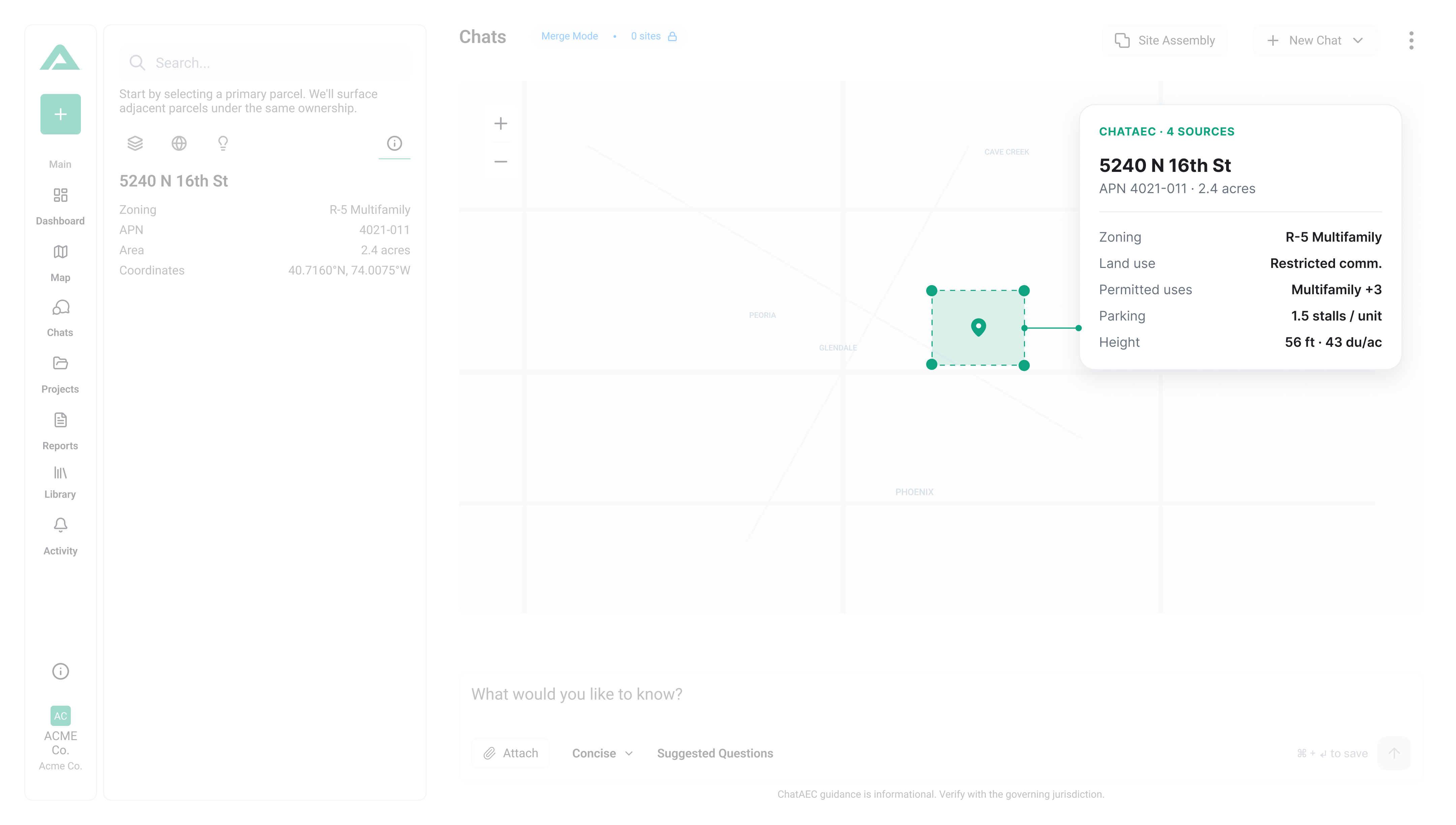
Urban street scene with modern high-rise buildings behind a graphic overlay showing a ChatAEC zoning map and details including overlays

Zoning answers in seconds. Due diligence in minutes, not weeks.

ChatAEC is a conversational AI built for development professionals. With ChatAEC, anyone who plans, finances, or builds projects can cut through ordinances, overlays, and regulations to focus on building.
The Pain

Regulatory research is still manual, fragmented, and slow.

Municipality icon
Digging through municipal code PDFs
Municipal code icon
Conflicting overlays and exceptions
Rework icon
Rework caused by missed requirements
Searching icon
Stakeholders stuck answering repetitive questions
The solution

What ChatAEC Does

ChatAEC is a regulatory intelligence tool designed for the built environment. It helps teams understand zoning, land use, and development requirements by retrieving and interpreting jurisdiction-specific regulations that apply to a given site.
ChatAEC conversational AI interface showing answer with a zoning map and polygon and zoning legend
What you get

One tool for teams, maps, and reports

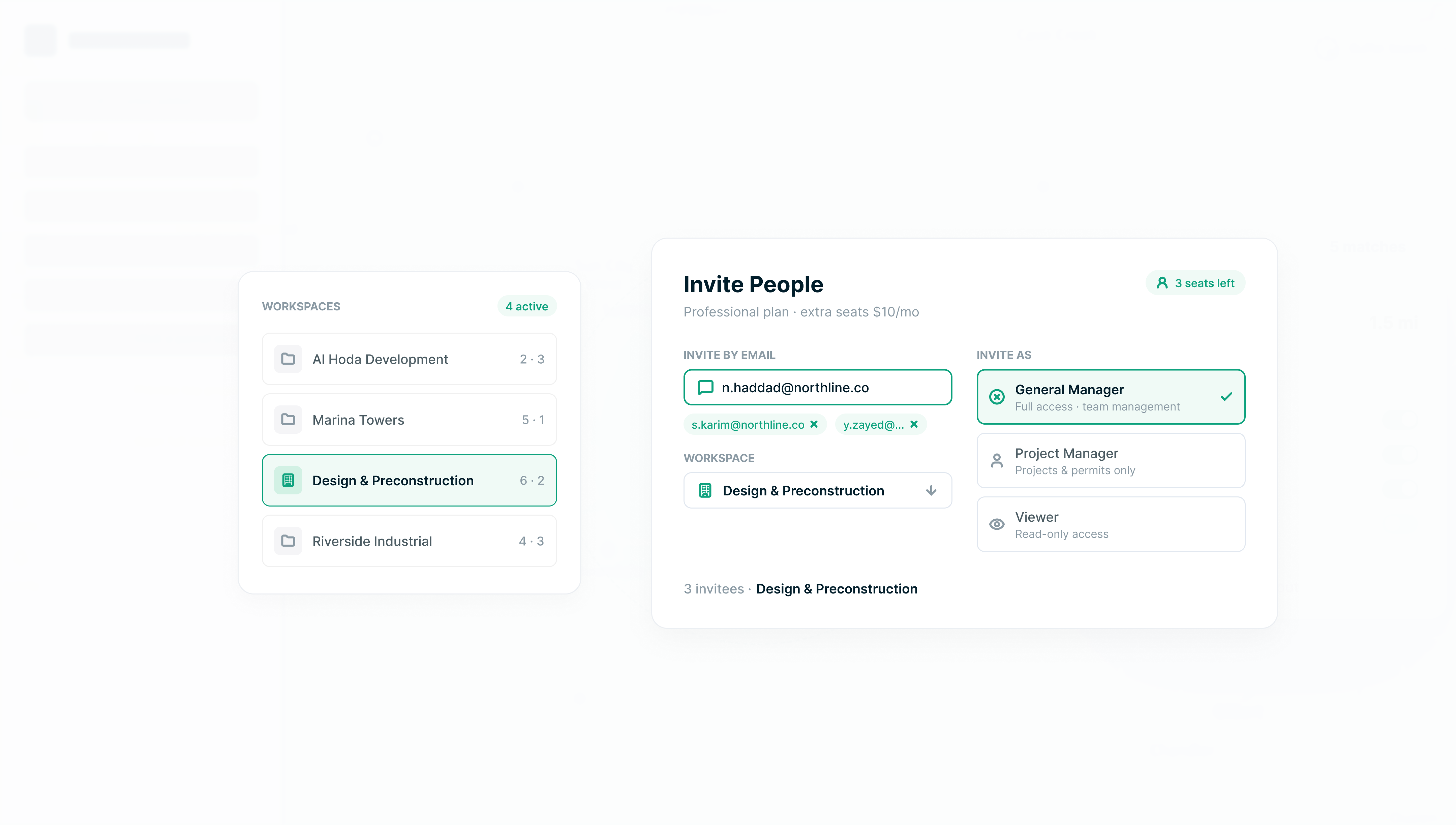
Bring your whole team into one workspace, and make site research and reporting more powerful.

Teams & organizations

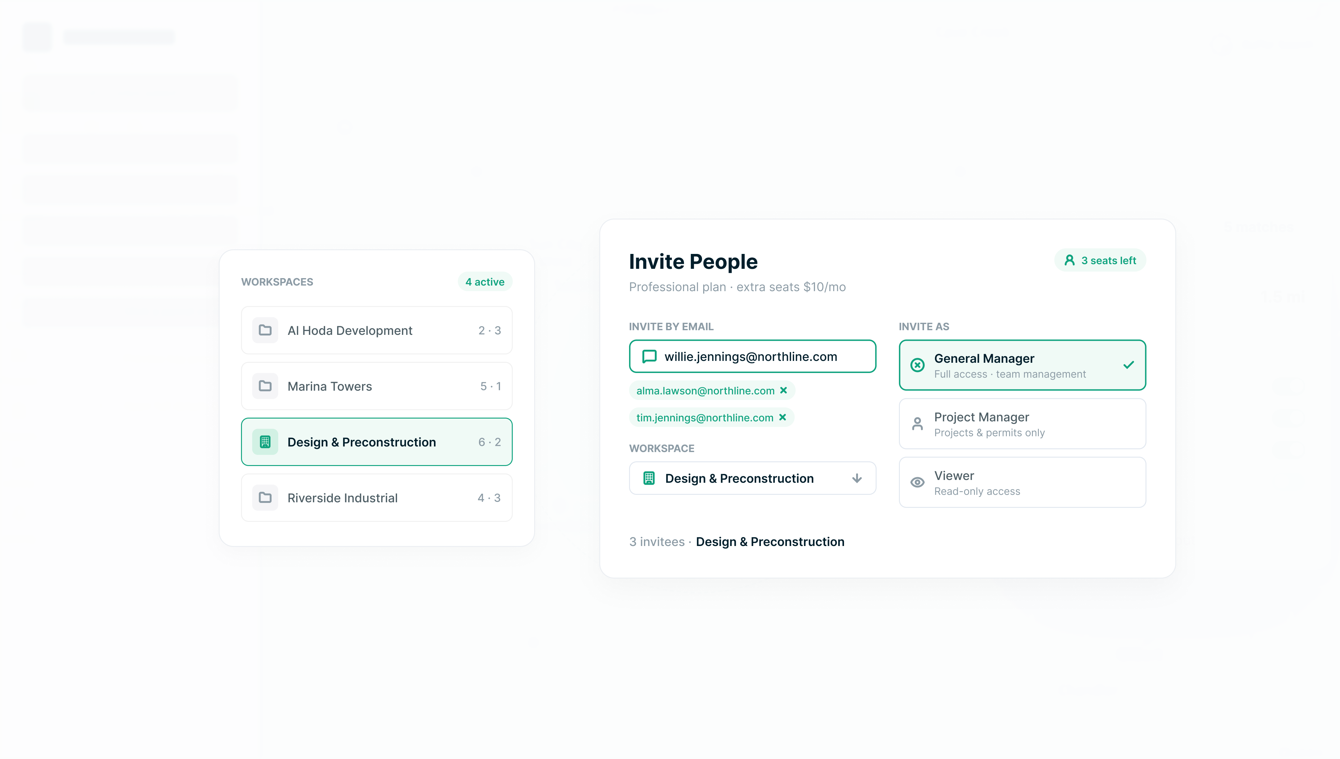
Switch between multiple workspaces from one login and give everyone the right level of access. Invite your team by email.

NDNorthwind Developers
CSCedar & Stone Architects
GLGranite Land Co.
OwnerAdminBilling AdminMember

Smarter maps

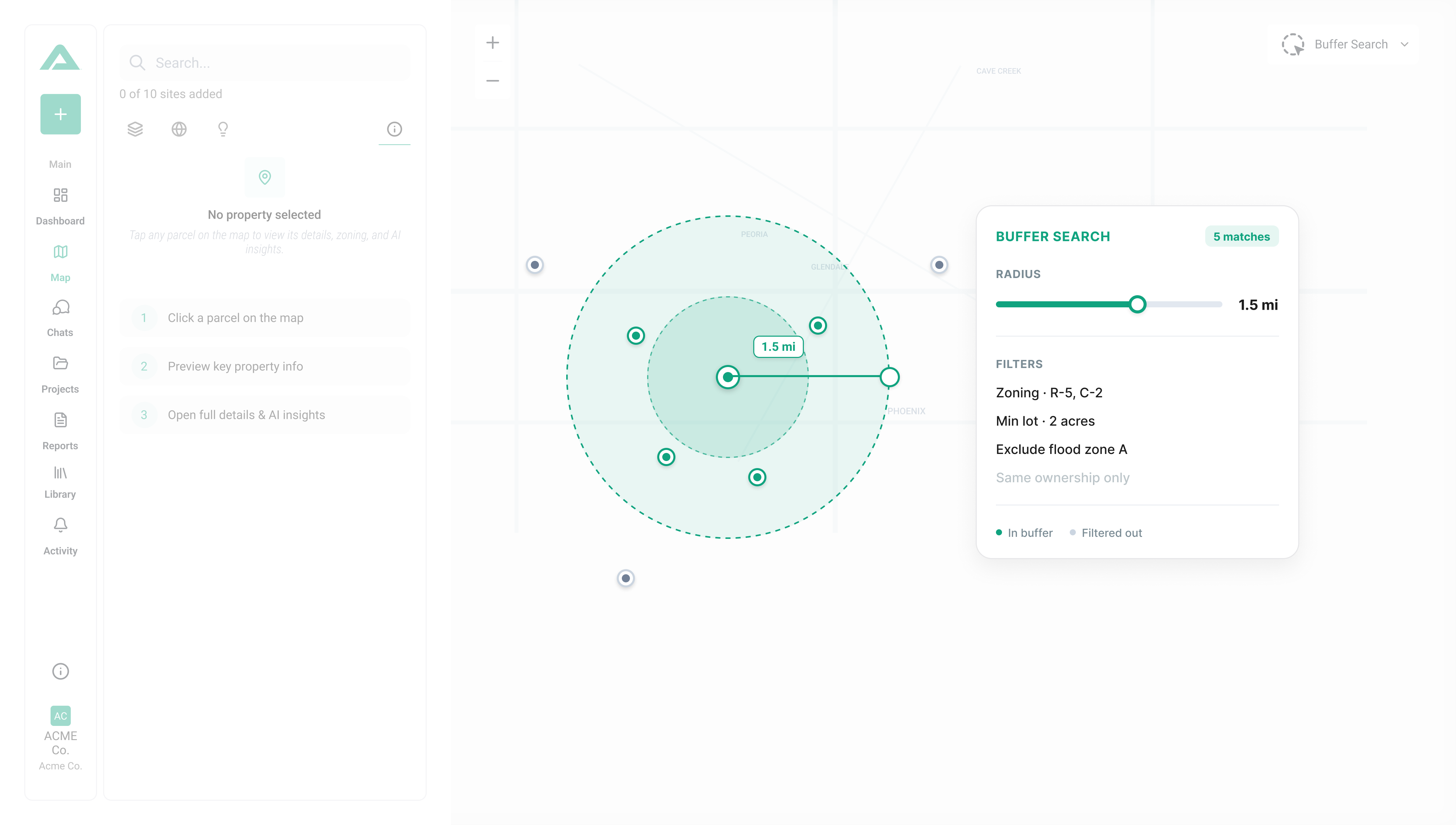
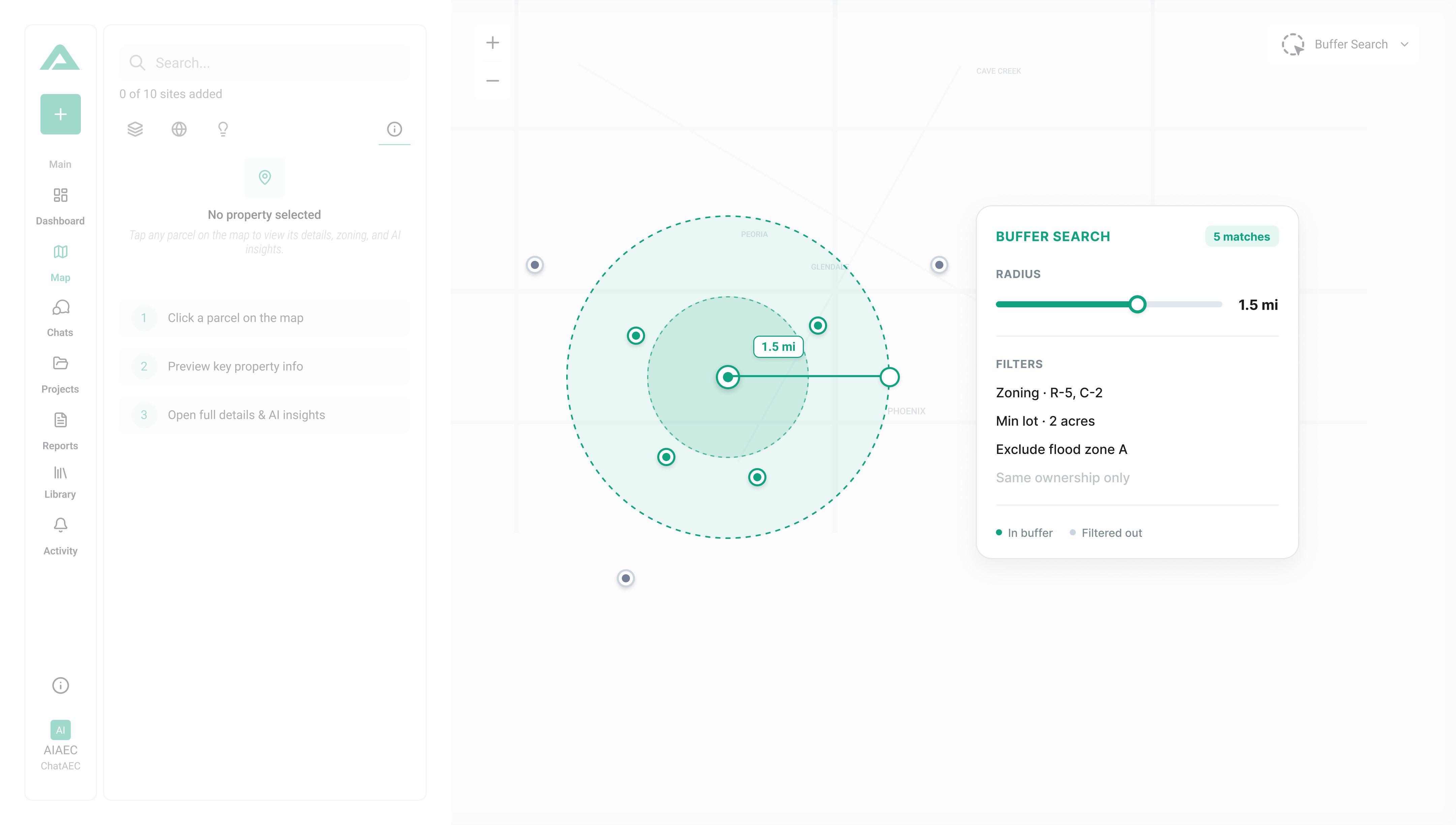
Study a site and everything around it, on its own or linked to a project.

500 ft buffer
Map workspaceBuffer analysisLayers & overlays

Stronger reports

Source-cited and client-ready, with code references on every report.

§ R-2
Source citationsCode referencesExport to PDF
Who it's for

Built for architects, developers, and real estate teams.

Coverage & Credibility

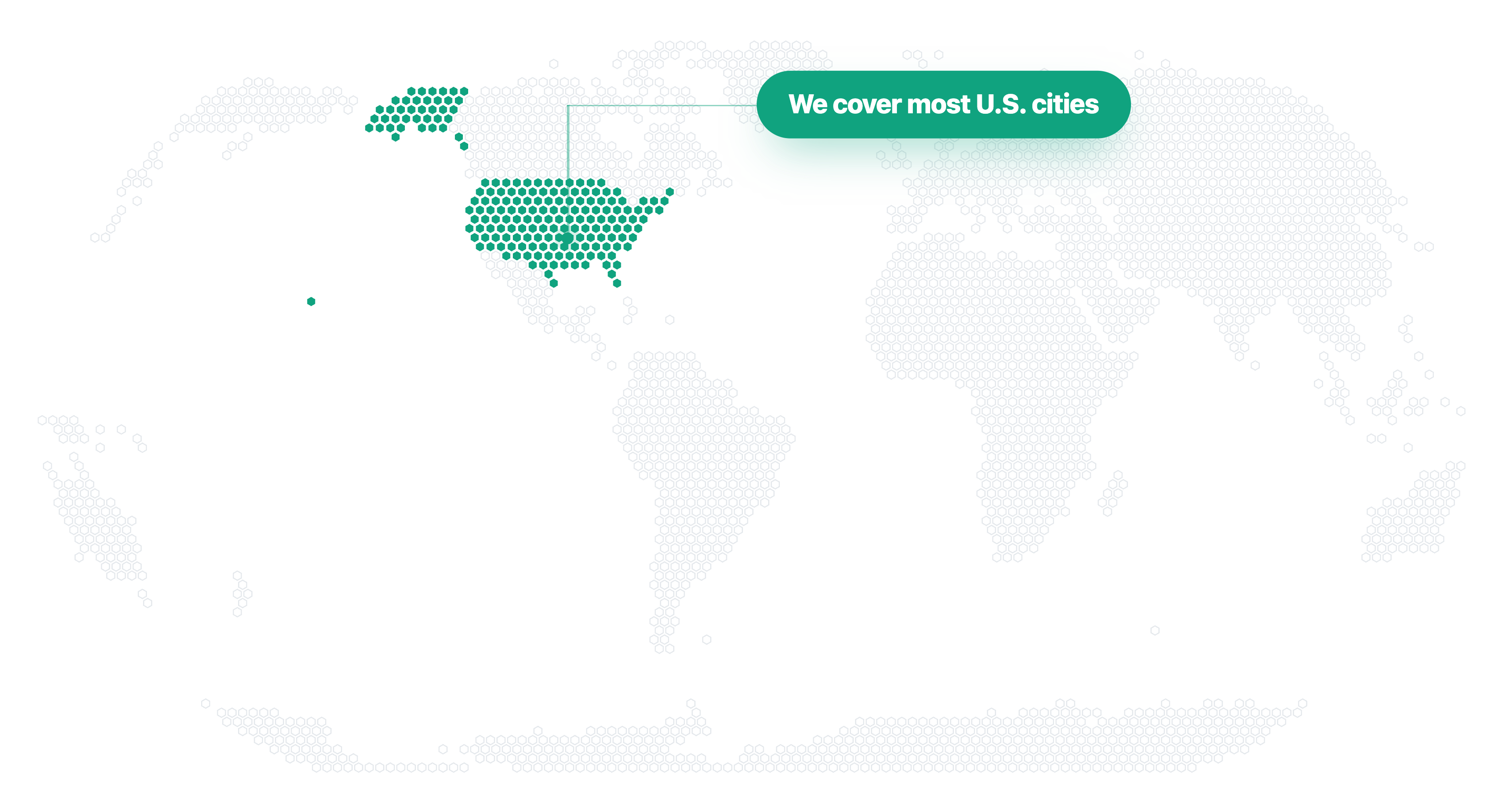
Growing coverage.

ChatAEC is built by professionals who have worked across real estate, planning, architecture, and development — and understand firsthand how complex and time-consuming regulatory research can be.
Arizona
Georgia
Utah
Colorado
Texas
North Carolina
South Carolina
Florida
Idaho
Image of files showing ChaAEC's data that includes Zoning codes, Land use maps, Overlays & Opportunity Zones,
Permitting requirements, Design and Development standards, and
ICC building codes

Data Includes

  • Zoning codes
  • General Plan land use maps
  • Overlays & Planned zones

  • Permitting requirements
  • Design standards
  • ICC codes
State interest

Let us know what state you're interested in.

Thank you! Your submission has been received!
Oops! Something went wrong while submitting the form.

Starting at $199/month

AI-powered zoning, entitlement, and due-diligence research for individuals, teams, and enterprise firms. Pull the full regulatory picture on any parcel, source-cited and report-ready, in minutes.
Team plan

We'd love to share more about our Team Plan.

Thank you! Your submission has been received!
Oops! Something went wrong while submitting the form.
HOW IT WORKS

How does ChatAEC work?

ChatAEC helps teams understand zoning, land use, and development constraints by combining regulatory questions, parcel-level data, and structured reporting into a single workflow.
Regulatory Q&A
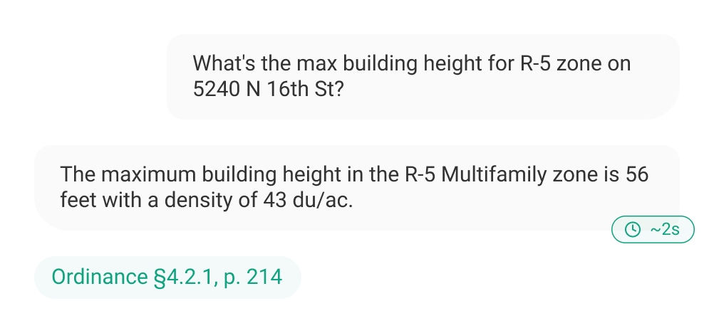
ChatAEC allows teams to ask zoning and development questions in natural language and receive clear, regulation-backed answers relevant to a specific site.
Zoning & land use
Permitted uses
Height & density limits
Parking requirements
Parcel & Site Intelligence
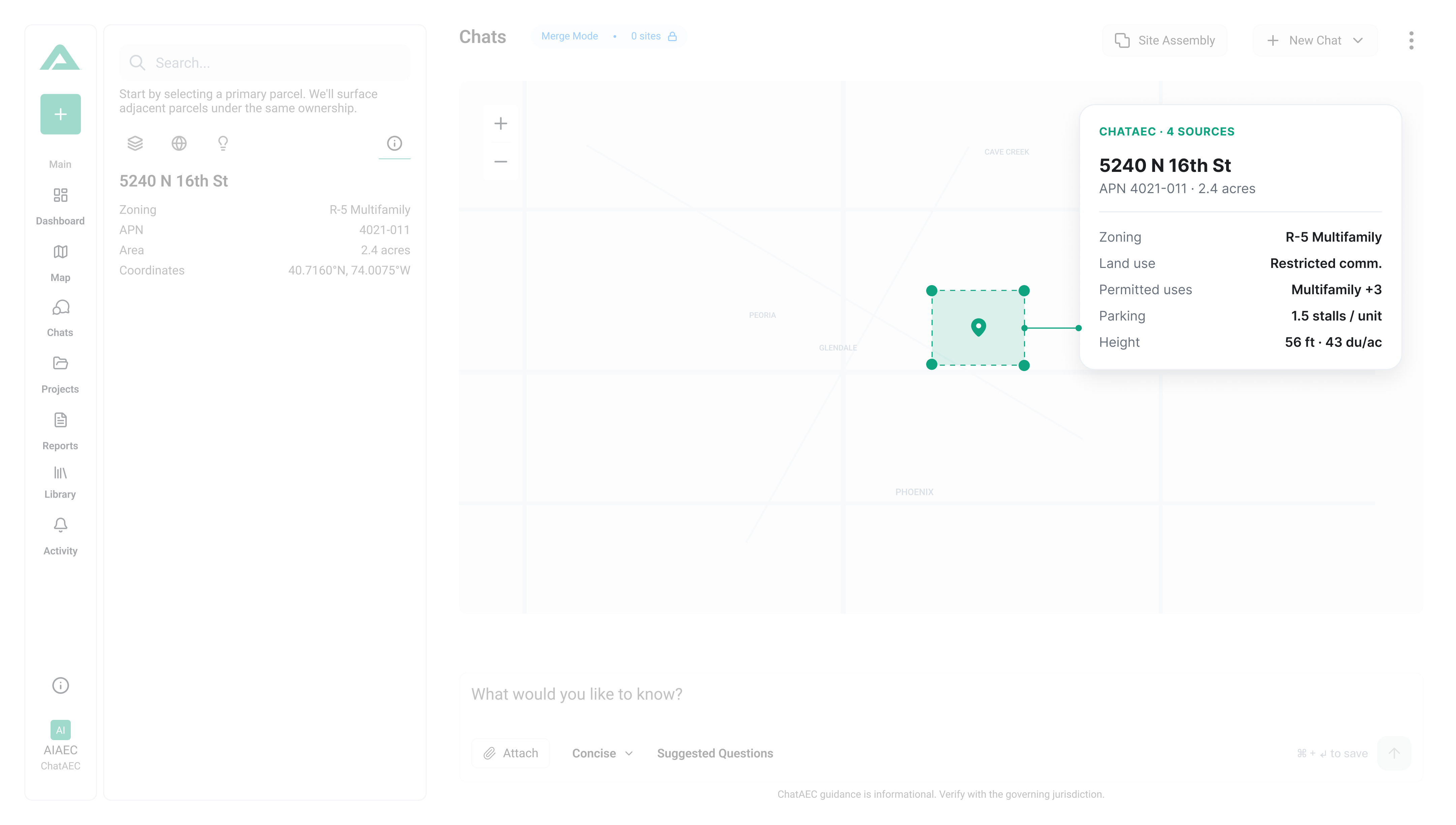
By identifying a site through an address or parcel number, ChatAEC summarizes applicable zoning designations, overlays, and site-specific constraints.
Address and APN lookup
Zoning designation
Overlay zones
Site constraints
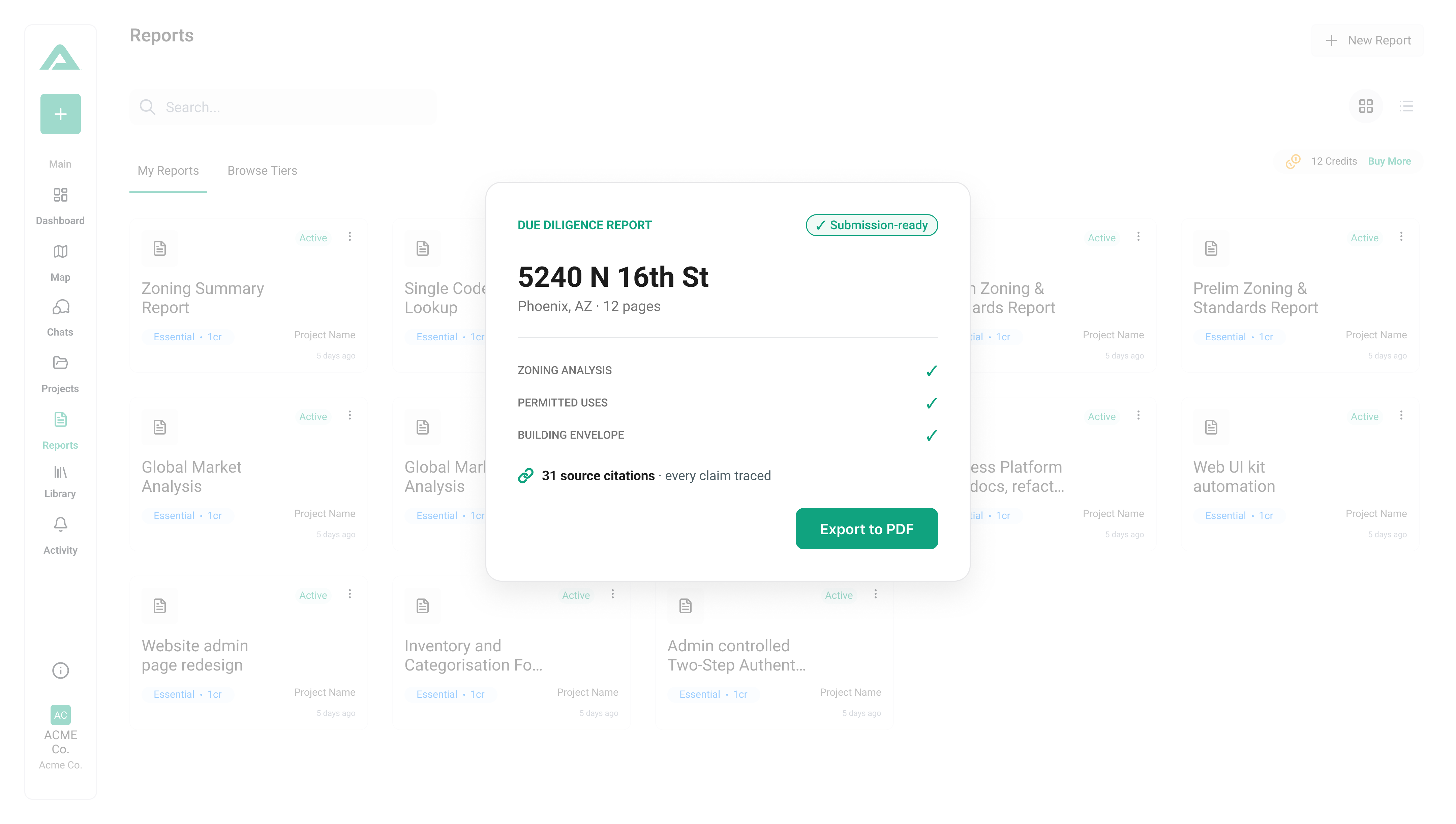
Due Diligence Report on screen showing aerial view of construction site with buildings under development.
Due Diligence & Reports
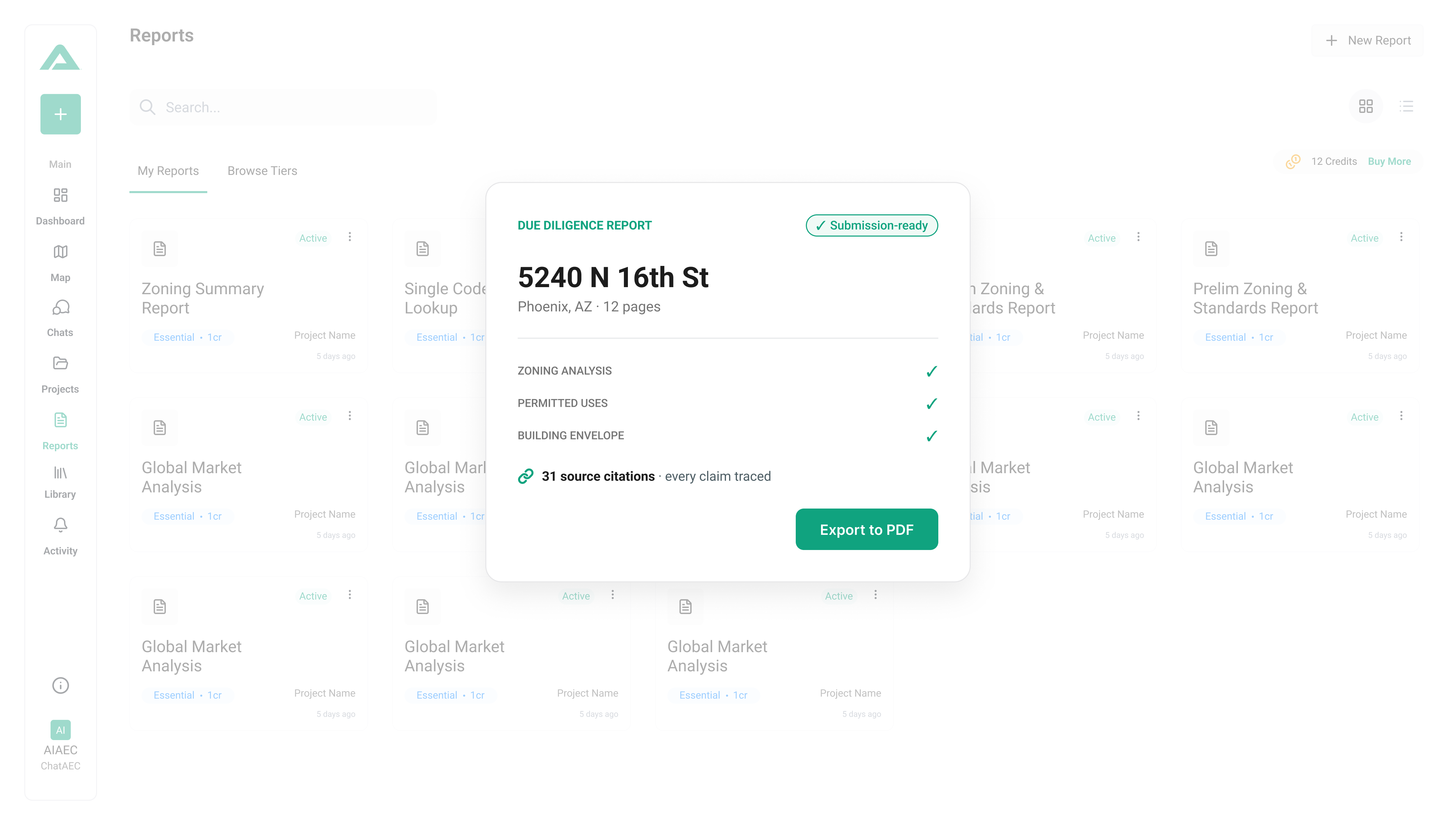
ChatAEC generates structured due diligence outputs that consolidate regulatory findings into clear, client-ready documentation.
Structured due diligence reports
Source-linked citations
Appendices and references
Exportable PDFs
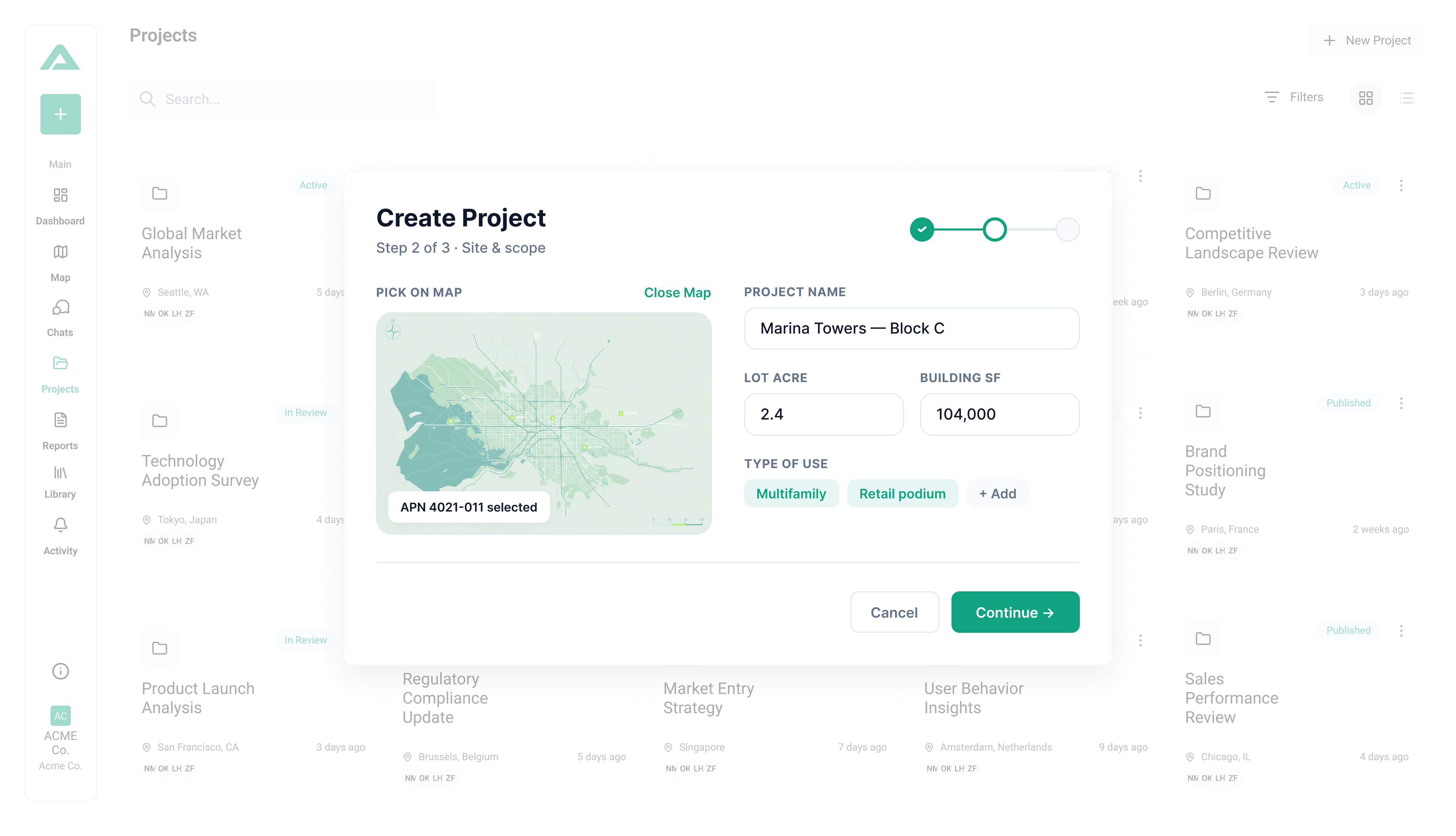
ChatAEC screenshot showing several real estate development projects managing SIRs, site research, zoning and regulation due diligence
Project Organization
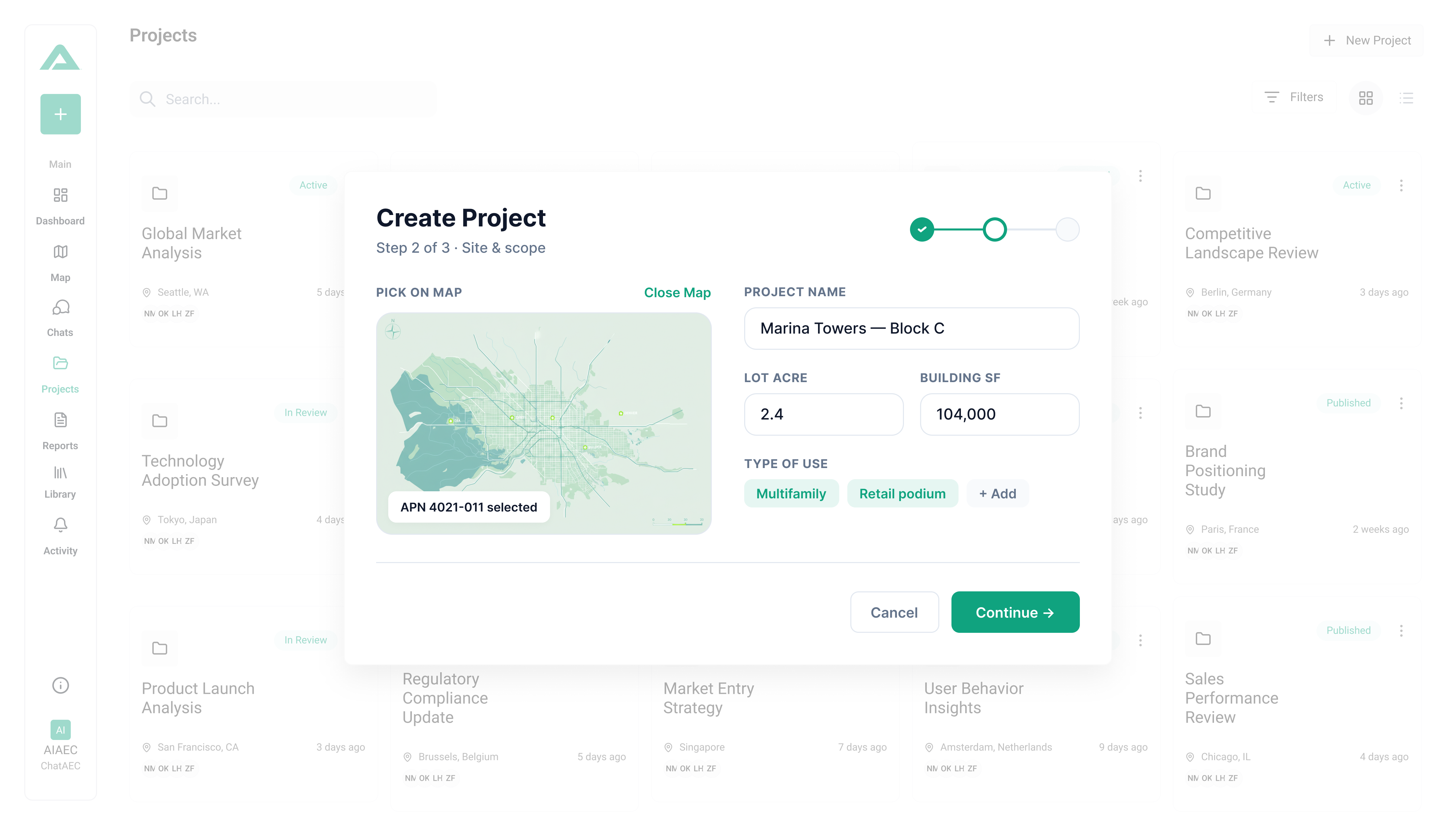
ChatAEC helps teams manage sites, reports, and regulatory outputs across multiple projects in one place.
Project dashboards
Interactive project maps
Saved templates
Reusable report formats
INTEGRATIONS

Partnerships that fit your existing workflow

ChatAEC integrates seamlessly with Autodesk and Esri, bringing zoning intelligence directly into design and planning workflows. Together, we’re enabling faster, more transparent due diligence — and better-built cities.
Autodesk logoesri logoICC International Code Council logo
TESTIMONIALS

What professionals are saying

“ChatAEC helps us with our early site research by making zoning and land-use constraints easier to identify and interpret. It helps us give more informed guidance to clients evaluating industrial and logistics opportunities in today’s complex markets."
John Werstler SIOR, Executive Vice President, CBRE
"ChatAEC makes it easier to interpret zoning information. Whether answering resident or developer questions or reviewing project feasibility, it improves efficiency and supports more informed conversations early in the process, helping set better expectations with applicants and allowing staff to focus more on planning outcomes rather than navigating code."
Brad Carr, AICP, LEED-AP, Planning & Development Manager, City of Scottsdale
"ChatAEC has significantly reduced the time it takes us to understand zoning constraints on a site. What used to take hours of manual research, including pulling jurisdiction-specific zoning codes, checking overlays, and confirming setbacks and density limits, now takes minutes. We can advance feasibility discussions faster, present options to clients with confidence, and move on deals before the competition even finishes their research."
Bill Finch Managing Partner, Unified CRE, LLC
Slide Left

ChatAEC has significantly reduced the time it takes us to understand zoning constraints on a site. What used to take hours of manual research, including pulling jurisdiction-specific zoning codes, checking overlays, and confirming setbacks and density limits, now takes minutes. We can advance feasibility discussions faster, present options to clients with confidence, and move on deals before the competition even finishes their research.

Bill Finch
Managing Partner, Unified CRE, LLC

ChatAEC makes it easier to interpret zoning information. Whether answering resident or developer questions or reviewing project feasibility, it improves efficiency and supports more informed conversations early in the process, helping set better expectations with applicants and allowing staff to focus more on planning outcomes rather than navigating code.

Brad Carr
Planning & Development Manager, City of Scottsdale

“ChatAEC helps us with our early site research by making zoning and land-use constraints easier to identify and interpret. It helps us give more informed guidance to clients evaluating industrial and logistics opportunities in today’s complex markets."

John Werstler
Executive Vice President, CBRE
FAQs

Frequently Asked Questions

ChatAEC supports zoning and development research across multiple U.S. jurisdictions and continues to expand coverage methodically based on regulatory availability and user needs.

Why can’t I just use ChatGPT or Claude instead of ChatAEC?

You absolutely can, and many people do. But here’s what you’ll run into:


General LLMs don’t have current, city-specific data.
ChatGPT and Claude have knowledge cutoffs and don’t automatically pull live zoning codes, planned overlays, or general plan designations. You’d need to manually feed them the right documents, and even then you’re often working with outdated county-level data instead of current city regulations.

You have to do the research before you can ask the question.
With a general LLM, you still need to track down zoning codes, municipal codes, and planning documents yourself. ChatAEC already has that data indexed and ready — you just ask the question and get an answer based on the most current city-level information.

No built-in AEC workflows.
General LLMs are powerful, but they aren’t designed around the workflows of architects, engineers, developers, and planners. ChatAEC is purpose-built for due diligence, feasibility analysis, zoning research, and permit planning, so outputs are structured for how you actually work.

Speed and reliability matter.
When you’re evaluating a site or preparing a submittal, you need answers fast and you need them to be right. ChatAEC is optimized for this — pulling the right data, summarizing it accurately, and delivering it in a format you can act on immediately.Think of it this way: You could use a general LLM the same way you could use Google. But just like you wouldn’t piece together a zoning analysis from 15 different search results, you don’t want to spend time prompting and re-prompting a general AI when you could get a complete, accurate answer in seconds.

How can I find sites to research in ChatAEC?

You can locate parcels by address, APN, or coordinates. You can also review our maps and drop a pin. Sites can be found using zoning maps, overlay maps, or general plan maps.

What questions can I ask ChatAEC?

There really aren’t constraints during early-stage design and development research, but most questions fall into a few common buckets:

  • What’s allowed? (zoning, uses, density)

  • What are the constraints? (setbacks, overlays, environmental)

  • What’s the process? (permits, timelines, fees)

  • Is this feasible? (can I build X on Y parcel?)

  • Give me everything. (due diligence reports, summaries)

What can ChatAEC answer?

ChatAEC interprets zoning codes, land-use regulations, and development standards for any parcel in its coverage area. You can ask about zoning designations, permitted uses, height and density limits, setbacks, parking requirements, overlay zones, environmental constraints, and preliminary site feasibility like allowable floor area and buildable area. It pulls together everything you’d normally have to dig through multiple documents to find — and gives you a clear answer in seconds.

Where do you get your information?

We go straight to the source, the cities themselves. ChatAEC pulls zoning codes, land-use regulations, general plan designations, and overlay information directly from municipal sources, not outdated county databases or third-party aggregators. That means you're working with the most current, accurate, city-level data available.